Services
- Administration
- Agriculture
- Animal Services
- Assessor
- Auditor
- Child Support Services
- Clerk Recorder
- Coroner
- County Counsel
- District Attorney
- Elections
- Emergency Services
- Environmental Health
- Farm Advisor/UC Co-op Extension
- GIS Data & Maps
- Health & Human Services
- Public Assistance & Aging
- Behavioral Health
- Public Health & Prevention
- Social and Placement Services
- Human Resources
- Information Services
- Library
- Museum
- Parks & Recreation
- Planning
- Residential Infill Project - Big Pine, Independence, Lone Pine
- Application Download
- Application Fees
- Housing
- Other Jurisdictions' Plans and Documents
- Planning Commission
- Current Projects
- Long Range Projects, Plans and Studies
- LAFCO
- Environmental Reviews
- Yucca Mountain Office
- Zoning Ordinance
- Code Enforcement - Zoning Violations
- Inyo County General Plan
- Surface Mining and Reclamation Act (SMARA)
- Staff
- Probation
- Public Administrator Public Guardian
- Public Works
- Sheriff
- CCW - Info & Permit Application Links
- Citizen RIMS
- Emergency Alerts
- Jail
- Job Opportunities and Recruitment Info
- Media & Press Releases
- MINT - Major Investigations & Narcotics Team
- Preparedness Updates
- Policies
- Property
- Records
- Report a Crime
- Search & Rescue
- Services
- Special Units
- Staff
- Weapons & Explosives
- Work Release (WRAP)
- Solid Waste
- Treasurer-Tax Collector
- Veteran Services
- Water Department
Public Maps
- Home
- Services
- GIS Data & Maps
- Public Maps
Public maps contain unrestricted data that can be viewed by the public. Most data shown in these maps are available for download or used as a feature service on the GIS Data Portal.
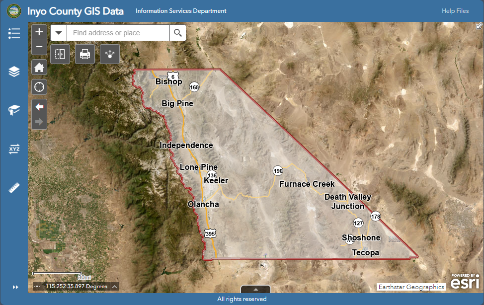
All GIS Data In One Map
All GIS Data In One Map
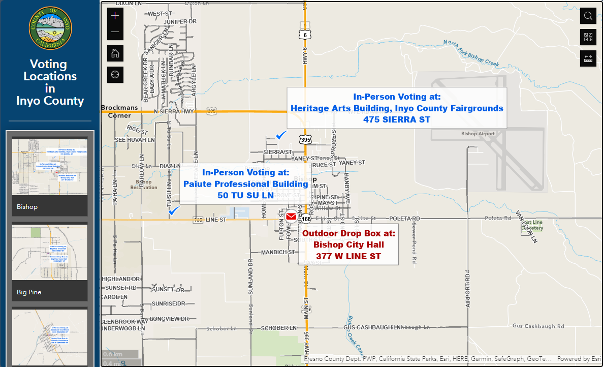
Voting Locations and Ballot Drop Boxes
Voting Locations and Ballot Drop Boxes
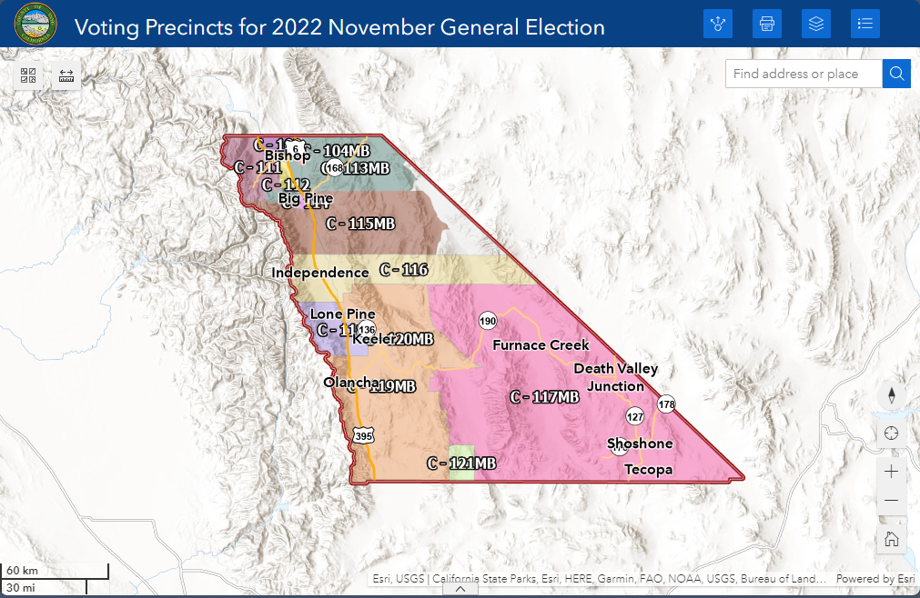
Consolidated Voting Precincts for November 2025 Statewide Special Election
Consolidated Voting Precincts for November 2025 Statewide Special Election
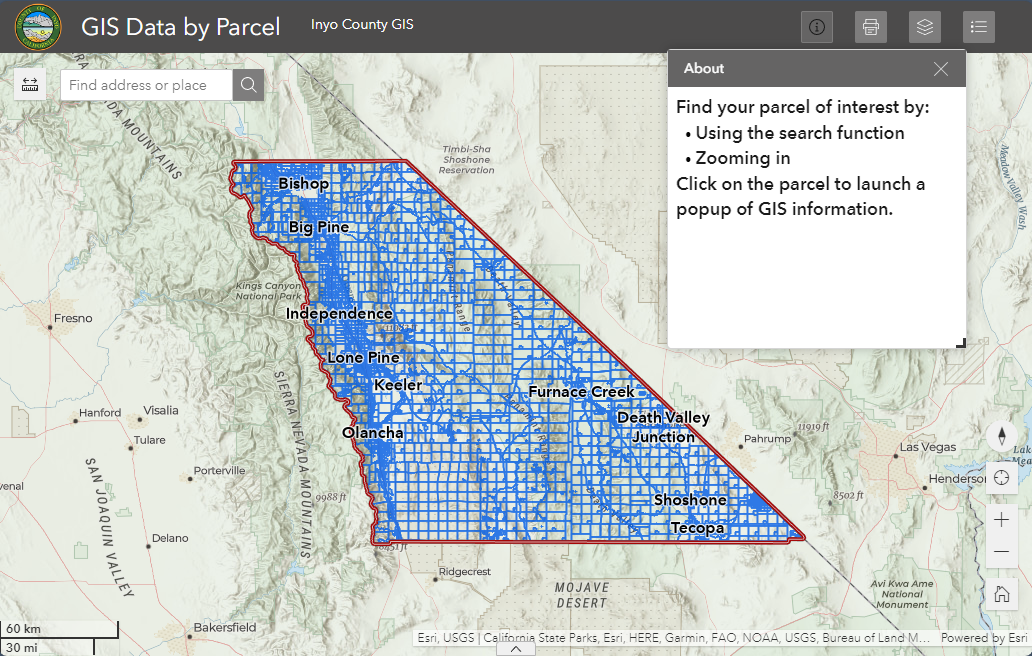
Get GIS derived information about individual parcels
Get GIS derived information about individual parcels
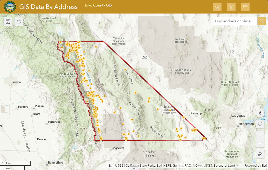
Get GIS derived information about individual addresses
Get GIS derived information about individual addresses
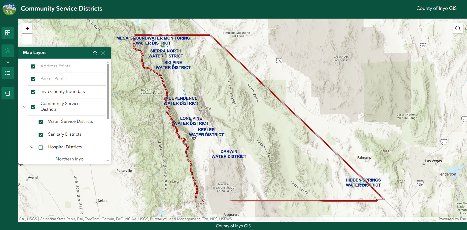
Community Service Districts
Community Service Districts
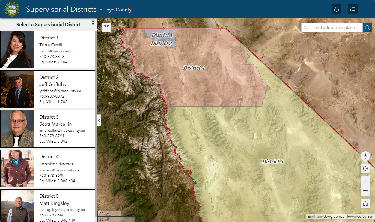
Supervisorial Districts
Supervisorial Districts
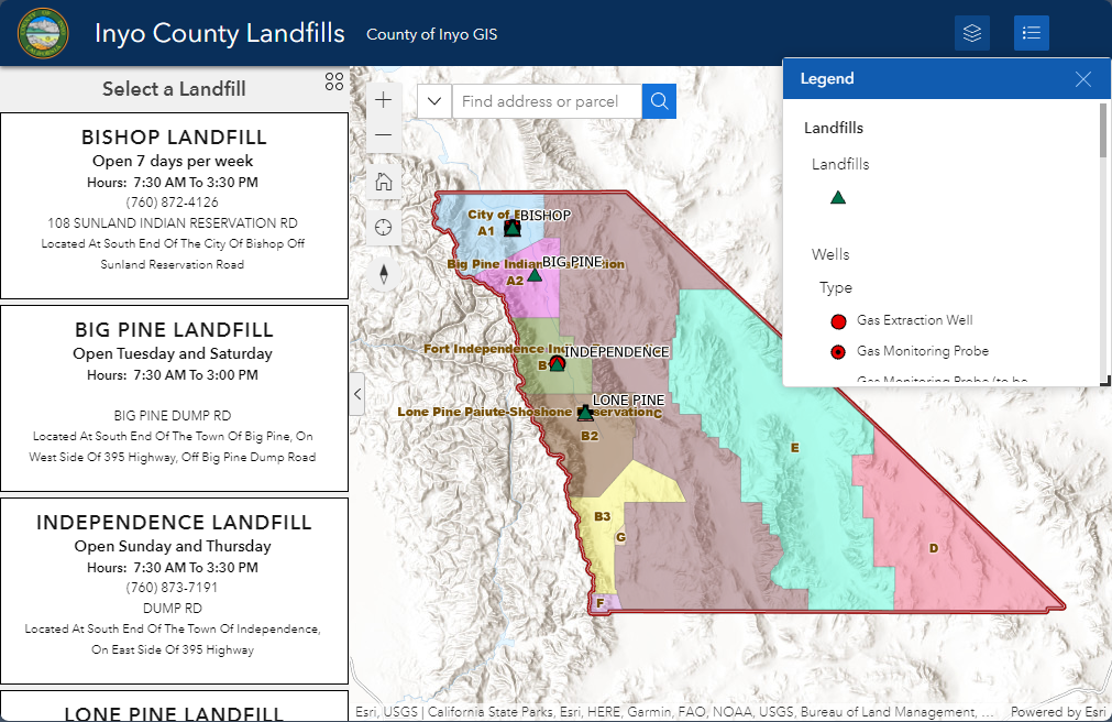
Landfills and Waste Permit Areas
Landfills and Waste Permit Areas
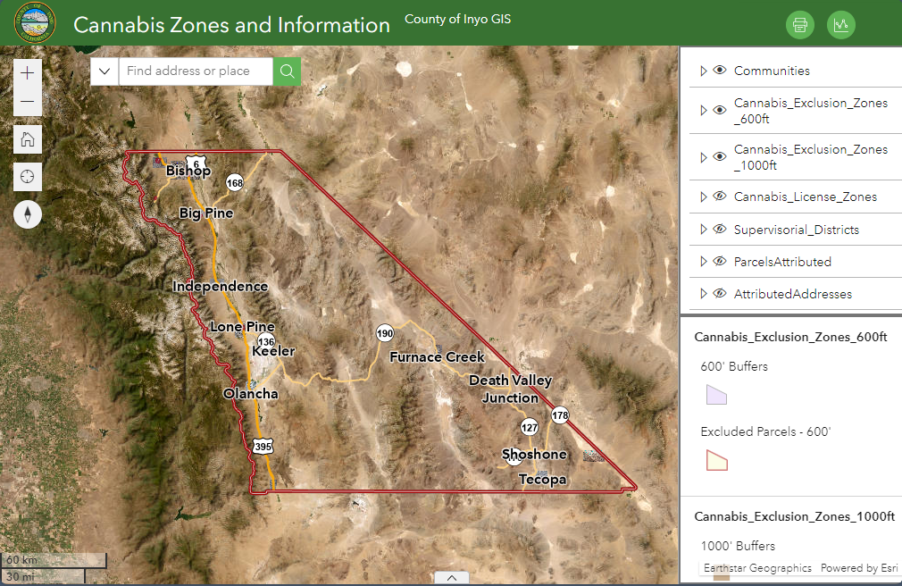
Cannabis Zones
Cannabis Zones
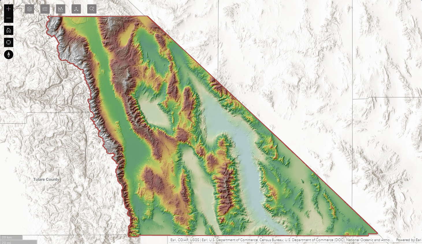
Elevation, Slope and Aspect Information
Elevation, Slope and Aspect Information
County maintained parks and campgrounds
County maintained parks and campgrounds
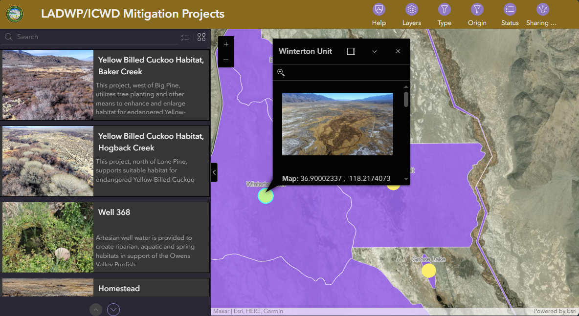
LADWP/ICWD Mitigation Projects
LADWP/ICWD Mitigation Projects